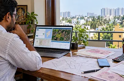
Buying property is more than just finding the right location and comparing prices. Every land parcel has a formal identity in government records and for many urban properties in Maharashtra that identity is the CTS number. In this guide, Omshakthy Homes explains what the CTS number is, where to find it and why it is important to verify before making a purchase.
The cts number meaning is a unique reference assigned to a land parcel through the city-survey system in notified urban areas. It helps the land-records department identify the exact property represented in official records.
The commonly used cts number full form is City Survey Number, although some property references expand CTS as City Title Survey or Chain and Triangulation Survey. Since terminology can differ across sources and locations, buyers should rely on the exact number shown in official records and registered documents.
In simple terms, a CTS number works like an identification code for an urban plot. It helps distinguish one parcel from another, even where nearby sites have similar postal addresses.
Consider a plot described as “CTS No. 245/3, Village A, Taluka B.” Here, the number identifies the specific city-survey parcel connected to that property.
This cts number example also shows why an address alone is not enough for verification. A building name, street name, or landmark may change over time, but the official land-record reference is intended to connect the property with its survey details.
The cts no of property should be checked against the property card, registered sale deed, approved layout documents, and other relevant records. A mismatch may indicate an entry error, a boundary issue, or that the documents relate to different parcels.
The cts number in the property card is generally shown as the key identifier for an urban land parcel. The property card, also called a Malmatta Patrak in Maharashtra, is maintained for properties within city-survey limits.
A property card can assist a buyer to review information such as recorded holder, area, assessment related information and property reference. It is an important check record, but it is not a substitute for a full legal title review.
Before signing an agreement, compare the CTS reference across these documents:
If there is any inconsistency, pause the transaction and seek clarification from the seller, the City Survey Office, and a qualified property lawyer.
The Acts survey number is generally used for land in an urban city-survey jurisdiction. Rather, survey number or gate number is used in case of rural/agricultural land records.
It is an important distinction because depending on where the property is and what category it falls into, the way to search and the backing records might be different. An urban plot can be traced through a CTS reference whereas a rural parcel can be traced through a survey or gate number.
Do not assume that a CTS number and a survey number are always interchangeable. Look at the revenue record of the land in question. Note the exact language used.
The cts number in 7/12 can be followed in some land records where the urban and revenue references are linked. But the 7/12 extract is more associated with rural and agricultural land records while the property card is the primary record for city-survey properties.
Services for viewing 7/12 extracts and property cards are available on the Maharashtra land-records portal. Instead of one record for all types of land, buyers have to choose the document relevant to the property’s jurisdiction.
For a plot purchase, it is wise to examine the land classification, survey reference, ownership entries, mutation history, encumbrance status, layout approval, and physical boundaries along with the CTS details.
Buyers who want to find cts number online can begin with the official Maharashtra Bhumi Abhilekh land-records portal. The portal offers services to view land records and download property-card information for applicable locations.
Follow these broad steps:
The available search fields may vary by region and record type. Use the official portal rather than depending only on third-party listings or screenshots.
When searching for a cts no online, start with the information already available in the sale deed, prior agreement, property-tax document, or old property card. This reduces the risk of selecting a similarly named village or an incorrect land parcel.
Correlate the number to the document schedule on the registered deed after viewing the record. Also compare location description, area and recorded holder. A pretty CTS number does not assure a clear title or even that the seller is the legal owner of the property.
If you're making a big transaction, have your lawyer look at it. Digital land records are useful for initial due diligence but a lawyer can check the chain of title, encumbrance certificates, mutations, approvals and any issues that may affect ownership.
Property verification is especially important when comparing plots in Chennai or evaluating emerging residential locations. Although CTS records are chiefly associated with Maharashtra’s city-survey system, the broader lesson applies everywhere: confirm the official land identifier and verify the document trail before paying a token amount.
Also, when looking for plots in guduvanchery, the same cautious approach is helpful. Buyers should check the survey details, parent documents, approvals, access and land-use status through the relevant Tamil Nadu authorities.
If you are looking for plots in avadi chennai, ensure that the layout has the required approval and verify that the plot reference in the deed matches the approved layout plan.
Plots available in maraimalai nagar need to check the revenue records approval status, road access and any conditions that may affect the construction or resale.
Similarly, the buyers searching for plots in poonamallee should verify the exact plot number, survey reference, boundary measurements and approval details before proceeding.
A CTS number is not merely a technical entry. It is one of the starting points for connecting a property on the ground with its official identity in government records.
The CTS number (City Survey Number) is a unique identifier assigned by the municipal authority to every property or land parcel in urban areas. On a property card, this number is crucial as it helps trace the original owner, identify property boundaries, and verify all legal details. The CTS number plays a key role in property registration, tax calculation, mutation, and verifying ownership, ensuring all records are in sync with official land records.
The survey number is a general land identifier used across rural and urban regions in India, while the CTS number is a specific type of survey number adopted in certain urban areas such as Mumbai, Pune, and some regions of Chennai. The CTS number is primarily for urban land record keeping, used for property registration, tax, and legal matters, while survey numbers are more broadly used for identifying any land parcels, especially in rural areas.
No, plot number and survey number are not the same. A survey number uniquely identifies a land parcel for official land and property records, while a plot number usually refers to a specific piece of land within a developed or plotted layout, such as a residential colony or project. Survey numbers are used for legal and governmental purposes, whereas plot numbers help in local identification within a particular layout or community.
To find the CTS number of a property online:
In Mumbai, the CTS number can be checked on the property card or by visiting the local municipal office. The CTS system is designed for city properties, and the number is available in all official land records relating to the property. One may also access this via the Maharashtra government’s official land and property records website using property details for accurate retrieval.
If the CTS survey number is wrong in land records or documents, raise a correction request at the Tehsildar’s office with supporting documents like the sale deed, patta, or property tax receipts. This can also be resolved by visiting the municipal or local survey office in person and submitting a written request along with necessary evidence to ensure legal ownership is properly reflected in official records.